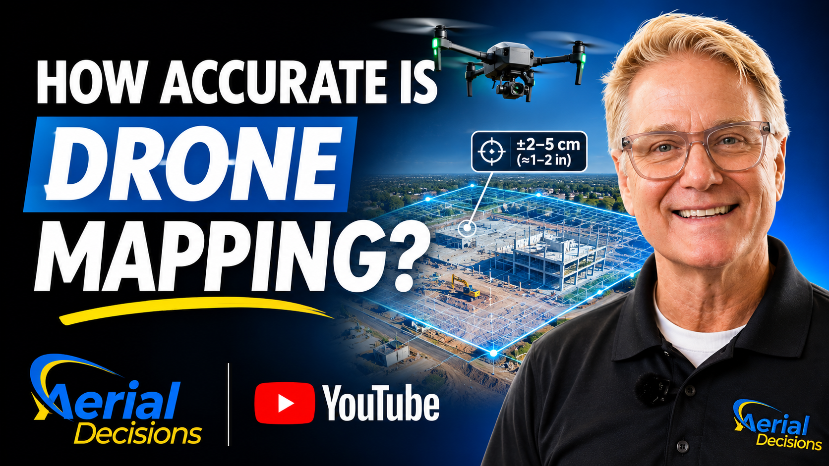
Why High Resolution Doesn’t Always Mean High Accuracy
The Drone Construction Intelligence Series – Part 12
Drone mapping has changed how commercial construction and civil engineering teams document, measure, and understand their projects.
Today, photogrammetry software can turn hundreds or thousands of overlapping aerial photographs into detailed orthomosaics, digital surface models (DSM), digital terrain models (DTM), and three-dimensional point clouds.
These deliverables can provide valuable information about construction site conditions.
However, there’s an important question that every project team should ask:
How accurate is the data?
A detailed image may look impressive. Yet visual detail alone doesn’t tell us whether the map represents the correct real-world positions or elevations.
Understanding that difference is essential when construction teams use drone data to support measurements, engineering workflows, and project decisions.
In this installment of the Aerial Decisions Construction Drone Intelligence Series, we’ll explain how drone mapping accuracy works, why it matters, and how teams can evaluate whether the data meets their project requirements.
Watch the Video: How Accurate Is Drone Mapping?
In this episode, Aerial Decisions founder Jim Gibson explains the difference between image resolution and positional accuracy, the roles of RTK and ground control, and why independent checkpoints matter.

Resolution vs. Accuracy: What’s the Difference?
One of the most common misunderstandings about drone mapping involves the difference between image resolution and positional accuracy.
Although the two concepts are related, they measure different things.
Resolution describes the level of detail visible in an image.
Accuracy describes how closely the mapping data represents actual positions or elevations.
For example, a drone might capture imagery that clearly shows pavement markings, construction materials, and other small features.
However, that detail doesn’t guarantee that those features appear at their correct geographic coordinates.
A map can look exceptionally sharp while still containing positional errors.
What Is Ground Sampling Distance (GSD)?
Ground Sampling Distance, or GSD, describes the distance on the ground represented by one image pixel.
For example, a GSD of 2 centimeters per pixel means each pixel represents approximately 2 centimeters on the ground.
Generally, a smaller GSD allows the image to show finer details.
However, a smaller GSD does not automatically guarantee better positional accuracy.
Other factors, including camera calibration, positioning, ground control, and processing quality, also affect the final results.
Therefore, construction teams should evaluate image detail and positional accuracy separately.
Relative Accuracy vs. Absolute Accuracy
Drone mapping professionals also distinguish between relative and absolute accuracy.
Relative Accuracy
Relative accuracy describes how consistently the dataset represents the positions of features in relation to one another.
For example, the distance between two visible objects may be reasonably consistent even if the entire map has a geographic offset.
This can be useful for certain measurements and comparisons within a dataset.
Absolute Accuracy
Absolute accuracy describes how closely the mapping data matches positions in a defined real-world coordinate system.
This becomes especially important when teams need to compare drone data against survey control, engineering plans, or other geospatial information.
For example, an orthomosaic may look correct internally but appear shifted when an engineer overlays it on a site plan.
That shift can indicate a problem with absolute positioning, coordinate systems, or other parts of the mapping workflow.
The key distinction is that relative consistency does not guarantee correct real-world positioning.
What Is RTK Drone Mapping?
RTK stands for Real-Time Kinematic.
RTK improves satellite-based positioning by applying correction information from a reference station or correction network.
In drone mapping, this helps establish more accurate camera positions during the flight.
As a result, RTK can improve the positional quality of the mapping workflow and reduce reliance on large numbers of ground control points.
However, RTK alone doesn’t guarantee that the final orthomosaic, terrain model, or point cloud meets a particular accuracy standard.
Several additional factors can affect the results.
These include image quality, camera calibration, flight planning, processing methods, coordinate systems, and site conditions.
Therefore, teams should still validate the finished data when accuracy matters.
What Is PPK?
PPK stands for Post-Processed Kinematic.
Unlike RTK, which applies corrections during data collection, PPK processes positioning observations after the flight.
Both methods can improve camera positioning.
The choice depends on the equipment, operating conditions, available correction data, and mapping workflow.
What Are Ground Control Points?
Ground Control Points, commonly called GCPs, are identifiable locations on the ground with accurately established coordinates.
Surveyors or qualified field personnel establish these coordinates using suitable measurement methods.
During photogrammetry processing, the software can use these known positions to help align the mapping data.
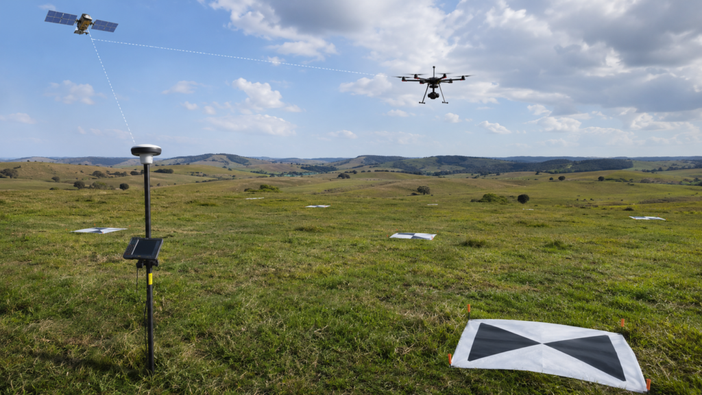
For example, a construction site might include several marked targets distributed across the project area.
The processing software identifies those targets in the drone photographs and uses their known coordinates to help constrain the model.
However, the number and placement of control points depend on the site, terrain, accuracy requirements, and mapping methodology.
More control points do not automatically guarantee better results.
Proper distribution and measurement quality matter.
Why Independent Checkpoints Are So Important
Ground control helps establish the model.
Independent checkpoints help evaluate the finished result.
This distinction is important.
A checkpoint is a location with known coordinates that the processing workflow does not use to adjust the model.
After processing, the mapping team compares the checkpoint’s known position or elevation with the corresponding position or elevation in the drone-derived dataset.
The differences provide evidence of mapping error at those locations.
For example, a project may use ground control points to establish the model while reserving additional surveyed locations for independent accuracy checks.
The team can then calculate accuracy statistics and report the results.
One common measurement is Root Mean Square Error (RMSE), which summarizes the size of coordinate differences across a set of checkpoints.
However, a useful accuracy report should also identify the coordinate system, measurement methods, number and distribution of checkpoints, and whether the reported results describe horizontal or vertical accuracy.
Accuracy should be demonstrated through appropriate validation—not assumed from the drone’s specifications.
Horizontal vs. Vertical Accuracy
Another important consideration is that horizontal and vertical accuracy are not necessarily the same.
Horizontal accuracy concerns position across the ground.
Vertical accuracy concerns elevation.
This difference matters because construction applications often depend heavily on elevation information.
For example, a project team may use an orthomosaic to evaluate material staging or access routes.
In contrast, grading, drainage, and earthwork calculations may depend on accurate elevation data.
A dataset that meets a project’s horizontal accuracy requirements may not necessarily meet its vertical requirements.
Therefore, teams should define both requirements before planning the mission.
How Accurate Does Construction Drone Mapping Need to Be?
There is no single accuracy standard that fits every construction project.
Instead, the required accuracy depends on the intended use.
| Construction application | Primary concern | Recommended approach |
|---|---|---|
| Visual progress documentation | Consistent imagery and viewpoints | Repeatable flights and reliable positioning |
| Site logistics and material staging | Clear spatial context | Georeferenced imagery appropriate to the task |
| Plan overlays | Horizontal alignment | Defined coordinate system and validated positioning |
| Stockpile volume analysis | Surface geometry and elevation | Appropriate control, surface modeling, and volume validation |
| Grading and earthwork | Horizontal and vertical accuracy | Project-specific accuracy requirements and independent checks |
| Engineering and survey applications | Defined professional standards | Licensed professional involvement where required, with documented accuracy |
These are general workflow recommendations, not guaranteed accuracy classifications.
The appropriate standard should come from the project’s technical requirements and intended decisions.
Case Study: Why Accuracy Requirements Change the Mission
Consider a commercial construction site where the project team requests monthly drone mapping.
During the early stages, the general contractor primarily wants to monitor progress, document site conditions, and compare material staging between missions.
A repeatable aerial workflow may provide the information needed for those tasks.
Now imagine the project enters a major earthwork phase.
The project team wants to compare terrain elevations, evaluate grading changes, and estimate cut-and-fill quantities.
Suddenly, the requirements change.
The team must consider the accuracy of the elevation data, the quality of ground control, the coordinate reference system, and the method used to validate the resulting terrain model.
A mapping workflow suitable for general progress documentation may not meet the requirements for earthwork measurement.
In this illustrative example, the drone hasn’t changed.
The intended use of the data has changed.
Therefore, the mission design and quality-control requirements must change as well.
This is why Aerial Decisions emphasizes understanding the client’s project objectives before establishing a mapping workflow.
The goal is to capture data that supports the intended application, rather than producing deliverables without first defining their purpose.
Does Drone Mapping Replace Traditional Surveying?
Drone mapping and traditional surveying can complement one another.
A drone can capture extensive site imagery and surface information across a large area.
Meanwhile, professional surveyors provide expertise in establishing control, evaluating accuracy, determining boundaries, and performing other regulated surveying services.
For many construction and civil engineering projects, combining these capabilities can create a more useful workflow.
However, drone-generated data does not automatically qualify as a professional survey.
The required licensing, standards, methods, and deliverables depend on the jurisdiction and project scope.
Therefore, when a project requires legally authoritative survey information, the appropriate licensed professionals should direct or perform that work.
The best approach is collaboration rather than treating drones as a universal replacement for surveying.
Why Accuracy Matters for Construction Intelligence
In earlier installments of our Construction Drone Intelligence Series, we introduced the framework:
CAPTURE → COMPARE → QUANTIFY → VALIDATE → DECIDE
Accuracy plays an important role throughout this process.
First, the team captures the site using a repeatable mapping workflow.
Next, it compares the new information with previous datasets or project plans.
Then, it quantifies changes where appropriate.
However, before relying on those measurements, the team must understand whether the data meets the accuracy requirements for the intended analysis.
Only then should the information support decisions within its demonstrated limitations.
For example, a month-over-month orthomosaic comparison might reveal visible changes in site access, material staging, or construction progress.
But precise elevation changes or earthwork quantities require additional confidence in the underlying measurements.
Construction intelligence becomes more valuable when teams understand both what the data shows and how much confidence they can place in it.
Frequently Asked Questions
1. How accurate is drone mapping?
Drone mapping accuracy varies based on the aircraft, camera, positioning system, flight planning, ground control, processing methods, and site conditions. There is no universal accuracy figure. Projects requiring specific accuracy levels should use independent checkpoints and documented validation procedures.
2. Does RTK make drone mapping survey-grade?
Not automatically. RTK improves camera positioning, but final mapping accuracy also depends on other factors. Survey-grade applications may require additional controls, validation, professional oversight, and compliance with applicable standards.
3. What is the difference between RTK and PPK?
RTK applies satellite-positioning corrections during data collection. PPK processes positioning observations after the flight. Both methods can improve camera positioning, but neither guarantees a particular accuracy level by itself.
4. Are ground control points necessary when using RTK?
Not always. Some RTK workflows can achieve suitable results with limited or no ground control points. However, the need for control depends on the project, equipment, site conditions, and accuracy requirements. Independent checkpoints remain important for validating accuracy.
5. What is the difference between GSD and mapping accuracy?
GSD describes the ground distance represented by each image pixel. Mapping accuracy describes how closely the dataset matches actual positions or elevations. A low GSD can provide detailed imagery without guaranteeing accurate geographic positioning.
6. Why are independent checkpoints important?
Independent checkpoints allow teams to compare drone-derived measurements against known positions that were not used to adjust the model. This provides evidence of accuracy and helps identify potential errors.
7. Can drone mapping support grading and earthwork calculations?
Yes. Properly captured and processed drone data can support terrain modeling, surface comparisons, stockpile volumes, and cut-and-fill analysis. However, the team must establish suitable accuracy requirements and validation methods for the intended application.
8. Can drone mapping replace a licensed surveyor?
No, not where the project requires services reserved for licensed surveying professionals. Drone mapping can support surveying and engineering workflows, but professional requirements depend on the project and jurisdiction.
The Executive Takeaway
A beautiful orthomosaic isn’t necessarily an accurate orthomosaic.
Likewise, a highly detailed point cloud doesn’t automatically provide the precision required for engineering decisions.
The important question is not simply:
“How accurate can a drone be?”
Instead, construction professionals should ask:
“How accurate does our data need to be for the decision we’re making?”
Once the team answers that question, it can design the appropriate capture, processing, and validation workflow.
Ultimately, the objective isn’t to create the most detailed map possible.
It’s to deliver reliable information that supports better construction decisions.
Part of the Construction Drone Intelligence Series
This article is part of the Aerial Decisions Construction Drone Intelligence Series, an educational series exploring how drone technology, photogrammetry, reality capture, software, and AI can turn aerial data into practical intelligence for commercial construction and civil engineering.
Disclaimer
Drone mapping and data services provided by Aerial Decisions are intended for visual documentation, progress tracking, and general measurement purposes only. These services do not replace licensed land surveying, boundary determination, or engineering-grade deliverables.
From The Editor:
Do you need to hire a professional drone service provider for your project? To speak to an aerial data specialist, fill out a form, email us or for even faster response times, give us a call at (833) FLY-4YOU or (833) 359-4968. Check out our transparent pricing and watch this space as we expand on the above topics and more over the coming weeks and months.
If you like this post, feel free to click the share button at the bottom of the page. We appreciate you helping us by spreading the content we share on our blog.

Showcase Your Company on the Drones and Construction Podcast! If you’d like to be a featured guest on our podcast, send us an email: info@aerialdecisions.com and one of our crew will get right back to you to share the details.
About Aerial Decisions
YOUR DATA. YOUR INTELLIGENCE. YOUR CHOICE OF PLATFORM.
Aerial Decisions is a Construction Intelligence company transforming jobsite reality into actionable data that helps contractors, owners, engineers, and municipalities make better-informed decisions.
We combine professional aerial and reality capture with advanced data processing, visualization, analytics, and AI-optimized technology to create a clear, measurable view of what is happening across a project.
Our platform-agnostic approach means your data isn’t locked into a single software ecosystem. We capture, process, visualize, analyze, and integrate construction intelligence into the tools and workflows your teams already use.
Supported by a network of FAA-certified, insured professionals and purpose-built technology, Aerial Decisions provides the visibility and intelligence project teams need—from pre-construction through completion.
Capture → Process → Visualize → Analyze → Integrate