
Construction Drone Adoption Is Growing
The Next Opportunity Is Turning Drone Data Into Construction Intelligence
My Perspective
I’ve spent a lot of time talking with General Contractors, Owners, engineers and public agencies about drones, and I’ve noticed a consistent pattern.
Most people already understand the value of aerial photography and progress monitoring. What they’re often less familiar with is everything that can happen after the drone lands.
That’s why the new drone-usage research from Associated Builders and Contractors caught my attention.
Only about one-third of contractors surveyed are flying drones today. And among those who are, progress monitoring and marketing are far more common than some of the advanced mapping and data applications we’ve been discussing with our clients.
To me, that’s not a negative.
It’s an enormous opportunity.
The next stage of construction drone adoption isn’t simply getting more drones onto jobsites. It’s making the data they collect easier to access, integrate and use to make better construction decisions.
That’s where things get interesting.
Construction Drones Have Entered the Mainstream — But We’re Still Early

Associated Builders and Contractors released its first Drone Usage report in August 2026, based on a May survey of its contractor members.
The headline number is significant:
36.1% of responding contractors reported flying drones.
Nearly 75% of the contractors surveyed work in commercial construction, making the findings particularly relevant to the projects and clients we work with every day.
DroneLife’s Jim Magill subsequently highlighted another remarkable finding: among respondents using drones, 97.1% identified DJI as their primary drone manufacturer, illustrating just how concentrated the industry’s current hardware environment has become.
But the statistic I find most interesting isn’t 97.1%.
It’s 36.1%.
Because that means almost two-thirds of the contractors surveyed aren’t flying drones yet.
For a technology capable of collecting so much useful project information, there’s still substantial room to grow.
What Are Construction Companies Actually Doing With Drones?
ABC’s findings give us a fascinating picture of current adoption.
Among contractors using drones:
| Application | Contractors Reporting Use |
|---|---|
| Site progress monitoring | 80.8% |
| Marketing and media | 77.5% |
| Inspections and mapping | 50.0% |
There’s an important story hiding inside those numbers.
Construction has clearly embraced the visual value of drones.
Progress photos? Absolutely.
Marketing videos? Absolutely.
But only half of drone users reported using drones for inspections and mapping.
That’s where I believe the next major growth opportunity exists.
The Next Evolution: From Pictures to Data
A drone photograph tells you what a project looks like.
A properly captured and processed drone dataset can potentially tell you much more.
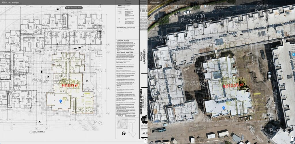
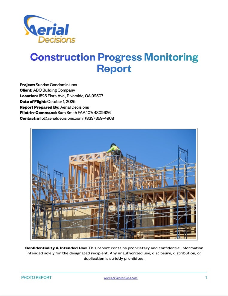
Depending on the project, drone data can support:
- Orthomosaic mapping
- Progress comparisons
- Stockpile and volume analysis
- 3D models
- Point clouds
- Digital surface and terrain models
- Site logistics
- Inspection documentation
- GIS workflows
- CAD and engineering workflows
- Executive reporting
That’s the transition we’re focused on at Aerial Decisions:
From drone imagery to construction intelligence.
The aircraft captures reality.
Photogrammetry and other technologies transform that capture into data.
Construction and engineering platforms make the information accessible.
And ultimately, people use that information to make decisions.
So What’s Holding Adoption Back?
ABC’s findings are particularly revealing here.
Among respondents, the leading challenges to adopting drone technology included regulatory and compliance issues at 53.5%, training and staffing at 43.4%, and limited use cases at 37.4%.
DroneLife’s coverage also reports 16.2% cited difficulty integrating drones into existing workflows.
I think those numbers deserve attention.
The challenge isn’t simply convincing contractors that drones work.
It’s making drones easy to operationalize.
Why Outsourcing Can Make Sense for General Contractors
This is also why I believe many contractors should evaluate whether building an internal drone department is actually necessary.
The ABC survey does not conclude that outsourcing is preferable; that’s my interpretation of the barriers it identified.
Think about what an internal commercial drone program can require:

FAA-qualified pilots, ongoing training, regulatory compliance, aircraft management, insurance, mission planning, specialized mapping expertise, data processing, software subscriptions, quality control and someone who understands how to deliver the resulting information into construction workflows.
And then there’s utilization.
If your team only needs specialized mapping at certain projects or milestones, maintaining all of those capabilities internally may not always make economic sense.
A qualified drone service provider can allow a contractor to access specialized pilots, aircraft, sensors, mapping capabilities and processing expertise when the project requires them.
The GC can focus on construction.
The drone provider can focus on collecting and transforming the data.
The Bigger Opportunity Is Integration
This is where I believe our industry needs to focus next.
Construction teams don’t need another isolated drone platform.
They need drone information that can flow into the environments they’re already using.
That could mean:
Procore for project management.
Civil 3D for civil engineering.
ArcGIS for geospatial information.
Bluebeam for project documentation and markups.
Or other CAD, BIM, GIS and construction-management environments.
The objective shouldn’t be to force everyone on a project to become a drone-data expert.
It should be to make the information easy for each stakeholder to consume in the tools they already understand.
Mapping May Be the Biggest Untapped Opportunity
The fact that only 50% of drone-using respondents reported inspections and mapping particularly stands out to me.
We’ve already seen what happens when a construction team moves beyond individual aerial photographs and sees an entire project represented as a measurable orthomosaic.
The conversation changes.
Now we can talk about:
What changed?
How much material moved?
Where was this condition located?
How does today’s site compare with last month?
Can engineering use this dataset?
That’s no longer drone photography.
That’s project information.
And AI Will Raise the Value Again
There’s another layer developing quickly.
Once construction teams create consistent, structured datasets over time, AI has something meaningful to analyze.
Imagine combining recurring reality capture with previous site conditions, inspection observations, schedules and other project information.
Instead of simply asking:
“Show me this month’s drone photos.”
We can begin asking:
“What changed?”
“What should I be paying attention to?”
“Where are conditions inconsistent with the previous capture?”
“What information should the project team review?”
That is where I believe construction drone intelligence is headed.
Mini Case Snapshot
Project Type: Southern California municipal infrastructure project
Starting Point: Drone imagery was initially valuable primarily for visual progress documentation.
Next Step: Recurring mapping introduced orthomosaic data and a complete measurable view of project conditions.
Opportunity: Make those datasets useful across existing GIS, engineering and project-management workflows rather than requiring stakeholders to work inside a dedicated drone environment.
Takeaway: The greater value wasn’t simply capturing more images. It was making the captured information more useful to more people.
What About the DJI Question?
The ABC survey’s 97.1% DJI figure deserves its own conversation, particularly given the changing U.S. regulatory environment.
For contractors, however, I think there’s a broader strategic lesson.
Don’t build your construction-data strategy around one aircraft manufacturer.
Hardware will change.
Regulations will change.
Software will change.
The valuable asset is the project’s historical information and the intelligence derived from it.
That’s another reason we’re committed to a platform-agnostic approach at Aerial Decisions.
Your data. Your intelligence. Your choice of platform.
Data Accuracy & Professional Use
Drone mapping can provide accurate, repeatable site information for progress monitoring, documentation, volume analysis, visualization and other construction applications.
It is important, however, to distinguish those applications from licensed professional surveying.
Drone mapping services are not intended to replace licensed land surveying, legal boundary determination or engineering-grade deliverables where professional licensure or certification is required.
We believe the strongest workflows allow drone professionals, surveyors, engineers and construction teams to work together—using the right data and expertise for the right application.
Frequently Asked Questions
How many construction companies currently use drones?
In ABC’s May 2026 survey, 36.1% of responding contractor members said they fly drones. Nearly 75% of the surveyed contractors work in commercial construction.
What are drones most commonly used for in construction?
Among drone-using respondents, 80.8% reported site progress monitoring, 77.5% marketing and media, and 50% inspections and mapping.
What prevents construction companies from adopting drones?
ABC identified regulatory/compliance issues, training/staffing and limited use cases as the three leading adoption challenges.
Should a General Contractor operate drones internally or outsource?
It depends on utilization, internal expertise and business requirements. Contractors with large, continuous programs may benefit from internal capabilities, while others may find that outsourcing provides access to specialized pilots, aircraft, mapping technology and processing expertise without building the entire capability internally.
What’s the next step in construction drone adoption?
We believe the next opportunity is moving beyond imagery toward structured drone data that integrates with existing construction, engineering and GIS workflows and ultimately supports better project decisions.
Executive Takeaway: We’re Only Getting Started
I don’t look at a 36% adoption rate and see a technology struggling for acceptance.
I see a technology that has already proven its value—and an industry with enormous room to expand how that technology is used.
The first chapter was putting cameras in the sky.
The next chapter is turning what those cameras capture into usable construction intelligence.
That means better mapping.
Better integrations.
Open, portable data.
Simpler workflows.
And increasingly, AI that helps construction professionals understand what’s changing across their projects.
The winners won’t necessarily be the construction companies flying the most drones.
They’ll be the companies making the best decisions with the data those drones collect.
Source Note
This article references the Associated Builders and Contractors 2026 Drone Usage Report and reporting by Jim Magill of DroneLife.
Read ABC’s Drone Usage findings
Read Jim Magill’s DroneLife analysis
Continue Reading – The Construction Drone Intelligence Series
- Part 1 – Drone Mapping in Commercial Construction
- Part 2 – Photogrammetry in Commercial Construction
- Part 3 – Drone Mapping Cost vs. Traditional Surveying
- Part 4 – Drone Construction Progress Tracking
- Part 5 – The ROI of Drones Isn’t the Flight—It’s the Decision
- Part 6 – Orthomosaic Mapping in Construction
- Part 7 – Construction Drone Deliverables Explained
Disclaimer
Drone mapping and data services provided by Aerial Decisions are intended for visual documentation, progress tracking, and general measurement purposes only. These services do not replace licensed land surveying, boundary determination, or engineering-grade deliverables.
From The Editor:
Do you need to hire a professional drone service provider for your project? To speak to an aerial data specialist, fill out a form, email us or for even faster response times, give us a call at (833) FLY-4YOU or (833) 359-4968. Check out our transparent pricing and watch this space as we expand on the above topics and more over the coming weeks and months.
If you like this post, feel free to click the share button at the bottom of the page. We appreciate you helping us by spreading the content we share on our blog.

Showcase Your Company on the Drones and Construction Podcast! If you’d like to be a featured guest on our podcast, send us an email: info@aerialdecisions.com and one of our crew will get right back to you to share the details.
About Aerial Decisions
YOUR DATA. YOUR INTELLIGENCE. YOUR CHOICE OF PLATFORM.
Aerial Decisions is a Construction Intelligence company transforming jobsite reality into actionable data that helps contractors, owners, engineers, and municipalities make better-informed decisions.
We combine professional aerial and reality capture with advanced data processing, visualization, analytics, and AI-optimized technology to create a clear, measurable view of what is happening across a project.
Our platform-agnostic approach means your data isn’t locked into a single software ecosystem. We capture, process, visualize, analyze, and integrate construction intelligence into the tools and workflows your teams already use.
Supported by a network of FAA-certified, insured professionals and purpose-built technology, Aerial Decisions provides the visibility and intelligence project teams need—from pre-construction through completion.
Capture → Process → Visualize → Analyze → Integrate