Part 7 – Construction Drone Deliverables Explained: What General Contractors Actually Receive
My Perspective
One of the biggest misconceptions I hear is that construction companies think they’re hiring us to fly a drone.
They’re not.
They’re hiring us to deliver information they can use to make better decisions.
The drone is simply the tool that allows us to collect that information safely, efficiently, and consistently.
When I meet with General Contractors for the first time, the conversation usually starts with questions about the aircraft, cameras, or FAA certifications. By the end of the meeting, we’re talking about project visibility, executive reporting, documentation, and reducing costly surprises.
That’s because the real value isn’t in the flight—it’s in the deliverables.
At Aerial Decisions, our goal isn’t to provide impressive drone footage. Our goal is to provide construction intelligence that helps project teams communicate better, document progress, and manage projects with greater confidence.
You’re Not Buying a Drone Flight—You’re Buying Better Information
Most commercial construction professionals understand that drones can capture incredible aerial imagery.
What many don’t realize is that the drone flight is only a small part of the process.
The real value comes from what happens after the flight.
Professional drone companies transform aerial data into deliverables that support project management, stakeholder communication, quality control, engineering workflows, and executive decision-making.
Think of the drone as the data collection tool.
The deliverables are what create value.
What Are Construction Drone Deliverables?
Construction drone deliverables are the digital products created from aerial imagery and collected site data.
Rather than receiving a folder full of random drone photos, professional clients receive organized information designed to answer specific business questions.
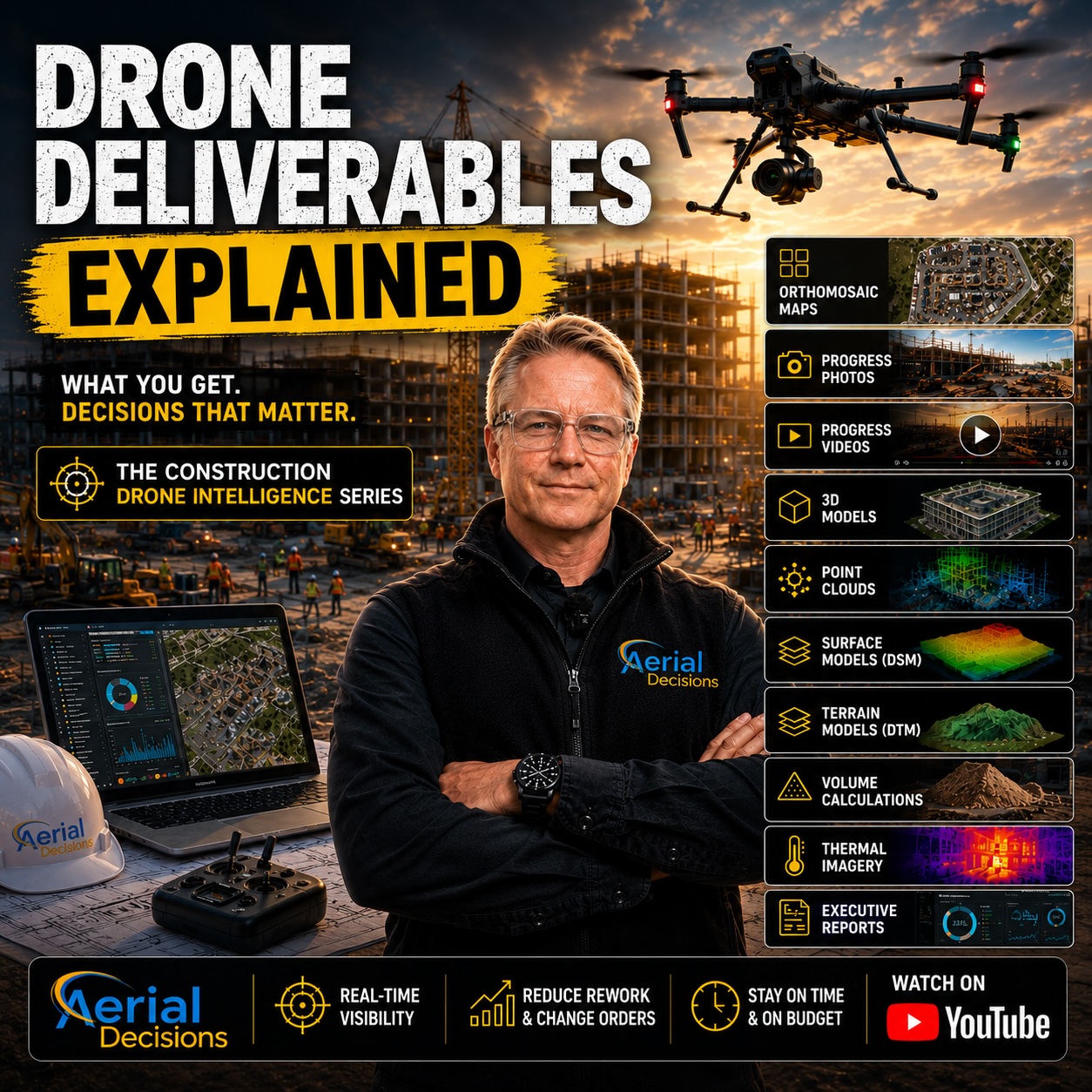
Examples include:
- Orthomosaic Maps
- High-resolution progress photography
- Construction progress videos
- 3D Models
- Point Clouds
- Digital Surface Models (DSM)
- Digital Terrain Models (DTM)
- Stockpile volume calculations
- Thermal imagery
- Executive reporting packages
Each deliverable serves a different purpose depending on the project’s goals.
The Most Valuable Drone Deliverables
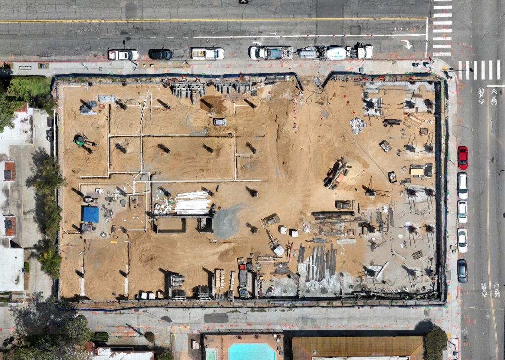
Orthomosaic Maps
One of the most requested deliverables we produce.
An orthomosaic combines hundreds of overlapping drone images into one measurable, geographically accurate map of the project.
Best used for:
- Progress tracking
- Site logistics
- Documentation
- Earthwork monitoring
- Executive reporting
Related Article: Orthomosaic Mapping in Construction: The Most Valuable Deliverable You’ve Probably Never Heard Of
Progress Photography
Professional progress monitoring includes much more than random aerial images.
Typical deliverables include:
- North, South, East & West cardinal photos
- Oblique overview images
- Detailed progress photos
- Critical milestone documentation
- Time-stamped archives
These become part of the permanent project record.
Construction Progress Videos
Monthly drone video allows Owners and executives to review an entire project in just a few minutes.
Videos typically include:
- Site flyovers
- Major milestones
- Areas of concern
- Schedule updates
- Executive summaries
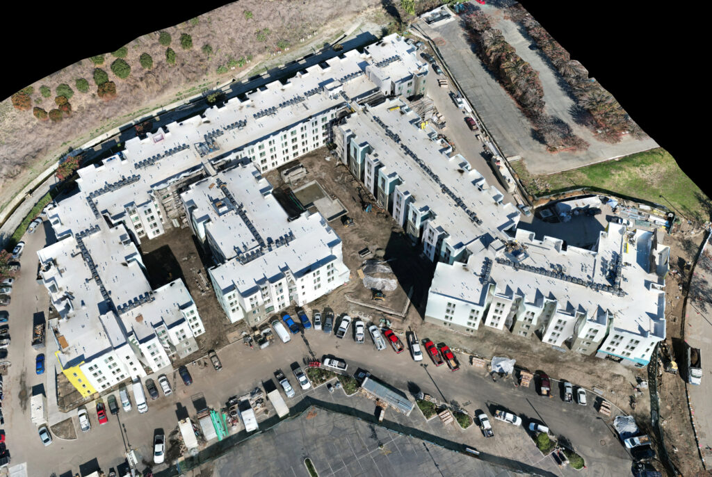
3D Models & Digital Twins
Some projects benefit from fully interactive 3D models.
These allow teams to:
- View projects from any angle
- Improve planning
- Document existing conditions
- Present projects to owners and stakeholders
Point Clouds
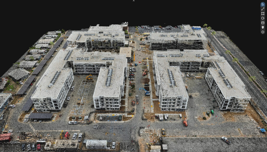
Point clouds provide millions of spatially accurate data points representing the project.
They’re commonly used by:
- Engineers
- Architects
- BIM teams
- Survey professionals
Digital Surface Models (DSM)
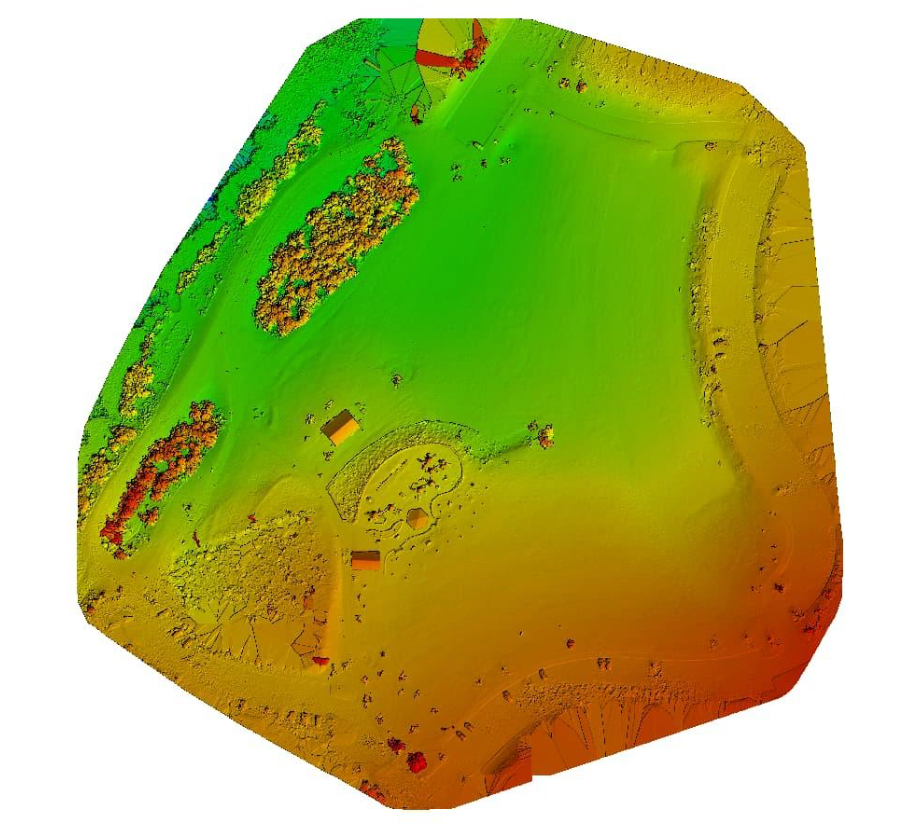
A DSM represents everything visible on the site:
- Buildings
- Equipment
- Vegetation
- Materials
- Terrain
Useful for site planning and earthwork analysis.
Digital Terrain Models (DTM)
Unlike a DSM, a DTM represents the bare earth beneath structures and vegetation.
DTMs are commonly used during:
- Site development
- Grading
- Drainage planning
- Earthwork evaluation
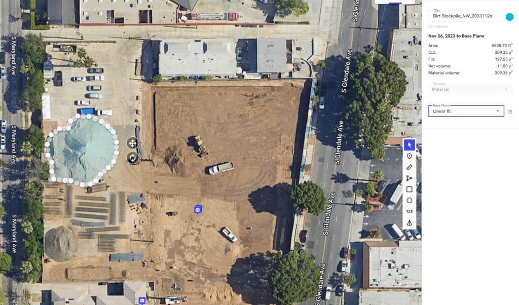
Volume Calculations
Drone mapping can calculate stockpile volumes quickly and consistently.
Typical applications include:
- Aggregate piles
- Soil movement
- Excavation progress
- Material inventory
Thermal Imaging
Thermal drones capture temperature differences that aren’t visible to the naked eye.
Applications include:
- Roof inspections
- Solar inspections
- Electrical systems
- Moisture detection
- Building envelope assessments
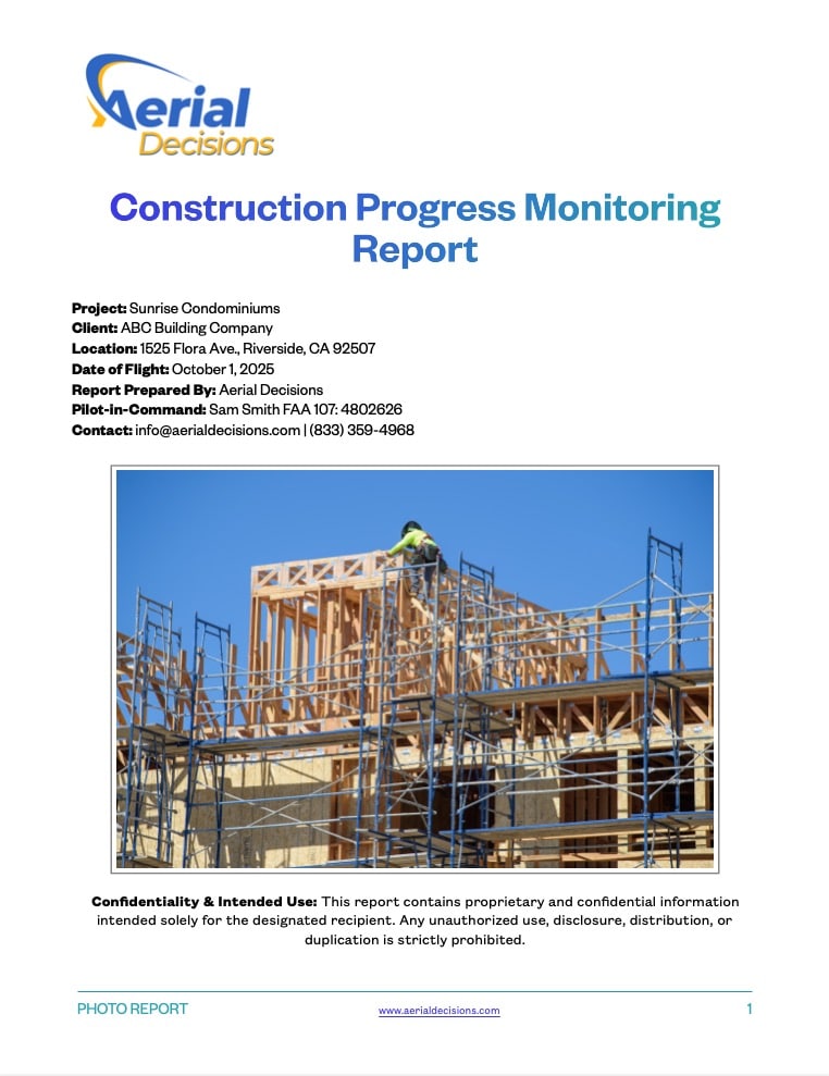
Executive Reporting
This is often the deliverable clients value the most.
Rather than reviewing hundreds of images, executives receive a concise report highlighting:
- Project progress
- Key milestones
- Areas requiring attention
- Site changes
- Supporting imagery
It transforms drone data into actionable business intelligence.
Choosing the Right Deliverables
Not every project needs every deliverable.
For example:
Commercial Building
- Progress Photography
- Orthomosaic
- Monthly Video
- Executive Report
Roadway Project
- Orthomosaic
- DSM
- Progress Photography
- Volume Calculations
Municipal Infrastructure
- Orthomosaic
- Point Cloud
- DTM
- Executive Reporting
The right package depends on the project’s objectives—not the drone.
Mini Case Study
Project: Mixed Use Apartment Complex
Challenge: Multiple stakeholders needed a consistent way to review monthly progress across a large-scale mixed use apartment complex construction project.
Solution: Monthly drone missions produced orthomosaic maps, standardized aerial photography, progress videos, and executive summaries.
Outcome: Project meetings became more productive because every stakeholder reviewed the same accurate, up-to-date visual information. Reporting became faster, documentation more consistent, and communication significantly improved.
Data Accuracy & Professional Use
Professional drone deliverables provide highly accurate, repeatable documentation for construction progress monitoring, planning, and project communication.
However, they are not intended to replace licensed land surveying, legal boundary determination, or engineering design services.
Licensed surveyors remain responsible for boundary establishment, legal surveys, and engineering-grade control. Drone deliverables complement these services by providing frequent, high-quality site documentation between traditional survey milestones.
Frequently Asked Questions
What are construction drone deliverables?
They are the digital products created from drone imagery, including maps, photos, videos, 3D models, point clouds, and reporting packages.
What is the most valuable deliverable?
For many General Contractors, orthomosaic mapping combined with executive reporting provides the greatest day-to-day value.
Can drone deliverables integrate with construction software?
Yes. Many deliverables can be incorporated into platforms such as Procore, Autodesk Construction Cloud, ArcGIS, Civil 3D, and Bluebeam, depending on project workflows.
How often should drone deliverables be updated?
Most commercial projects benefit from monthly updates, while fast-moving projects may require weekly or milestone-based flights.
Are all drone companies able to provide these deliverables?
No. While many companies capture aerial imagery, producing accurate mapping products, engineering datasets, and executive reporting requires specialized equipment, software, and expertise.
Executive Takeaway
The drone is the least important part of what we deliver.
What matters is the information that helps construction teams make better decisions.
Whether it’s an orthomosaic map, a progress report, a 3D model, or an executive dashboard, the right deliverables create clarity, improve communication, and provide a reliable visual record of every stage of construction.
At Aerial Decisions, that’s what we mean by Construction Intelligence.
Continue Reading – The Construction Drone Intelligence Series
- Part 1 – Drone Mapping in Commercial Construction
- Part 2 – Photogrammetry in Commercial Construction
- Part 3 – Drone Mapping Cost vs. Traditional Surveying
- Part 4 – Drone Construction Progress Tracking
- Part 5 – The ROI of Drones Isn’t the Flight—It’s the Decision
- Part 6 – Orthomosaic Mapping in Construction
- Part 7 – Construction Drone Deliverables Explained (Current Post)
Disclaimer
Drone mapping and data services provided by Aerial Decisions are intended for visual documentation, progress tracking, and general measurement purposes only. These services do not replace licensed land surveying, boundary determination, or engineering-grade deliverables.
From The Editor:
Do you need to hire a professional drone service provider for your project? To speak to an aerial data specialist, fill out a form, email us or for even faster response times, give us a call at (833) FLY-4YOU or (833) 359-4968. Check out our transparent pricing and watch this space as we expand on the above topics and more over the coming weeks and months.
If you like this post, feel free to click the share button at the bottom of the page. We appreciate you helping us by spreading the content we share on our blog.

Showcase Your Company on the Drones and Construction Podcast! If you’d like to be a featured guest on our podcast, send us an email: info@aerialdecisions.com and one of our crew will get right back to you to share the details.
About Aerial Decisions
Aerial Decisions is a Los Angeles-based Drone Services Provider (DSP). We specialize in providing cutting-edge drone data collection combined with industry leading software solutions tailored for the commercial construction industry. Our mission is to optimize the way enterprise construction projects are managed by offering precise aerial photography, detailed data analysis, and innovative software tools through a network of FAA-certified and insured drone pilots. Aerial Decisions is not just a drone service provider; we are your strategic partner in commercial construction. Our hands-on approach to understanding your unique requirements and our dedication to excellence ensures that every flight and every data point is optimized for your success. Trust us to be the eyes in the sky that elevate your construction projects to new heights.