by Jim Gibson
When it comes to marketing commercial real estate properties and land parcels, drones are powerful photography tools, offering a cost-effective and time-saving solution to capture aerial imagery for broker listings. So, what do real estate agents look for when hiring a commercial drone service provider? Here are our top five tips for shooting commercial real estate to capture a birds-eye view of expansive properties.
1) Start With the Basics
Understand State and Local Laws
As a Part 107 Remote Drone Pilot, you already know the ins and outs of FAA restricted airspace. But some states and/or cities may also prohibit aerial photography in areas like public parks. Additionally, many municipalities prohibit flights over private property without the express permission of the property owner. Avoid conflict by checking for local laws that may affect your specific mission.
Learn the Industry Jargon
You will be much better positioned to market your drone services if you take time to learn the jargon, understand the challenges that commercial real estate brokers are facing and develop a feel for what your Clients need.
Here are some basic terms that can help you understand commercial real estate industry jargon:
Anchor Tenant: A core tenant – typically a major retail chain with prestige and popularity to attract other retail tenants and consumers.
Pad Site: A pad site, or outparcel, is a freestanding parcel of commercial real estate located in front of a larger shopping center or strip mall. Common occupants of pad sites include banks and restaurants.
Offering Memorandum (OM): A presentation and legal document that summarizes an offering for potential investors.
Net Lease: By signing a net lease, the tenant agrees to pay one or more of the three major expense categories: taxes, maintenance, and insurance fees. Net leases are defined as follows:
- Single (net): Tenant pays one of the three expense categories
- Double (net-net): Tenant pays two of the three expense categories
- Triple (net-net-net): Tenant pays all three expense categories.
Mixed Use: A mixed use development is a property that can be occupied by various categories of tenants, which may include combined zoning for retail, residential, office, and/or industrial. A common form of a mixed-use property in urban areas features ground-level retail with apartments or office space above.
Deferred Maintenance: The practice of deferring needed maintenance or repairs on a property (e.g., potholes, broken gutters, crumbling sidewalks, missing roof shingles, peeling paint, etc.). Investors evaluating the purchase of a property must consider the negative impact of deferred maintenance on future cash flow.
2) Check the Map and Use a GPS Device
Vacant lots in rural areas do not always have a street address. In fact, the broker may just give you cross streets and a brief description of the property. Additionally, cell service may not be available in rural areas surrounding vacant land. As such, if you are shooting a vacant lot or working with a land development company, be sure to get exact GPS coordinates of the property, download and print driving directions before leaving, and bring a GPS device to make sure you are shooting the correct area.
3) Show Off the Value of the Property
Stage the Property
Your Client (the listing broker or real estate agent) should handle this in advance of your mission. Staging may include sprucing up building facades, paint, landscaping, signage, etc. The better your subject looks, the easier it is to get good photos and videos to help your Client market the property.

Highlight the Best Features
In addition to highlighting the property itself, be sure to get wide-angle shots that include any nearby mountains, streams, lakes, forest, scenic views, or other features in the frame. The goal here is to “show off” the best features of the property, along with proximity to roadways, highways, other retail space, shopping centers, land parcels and population centers. And, lastly, for restaurants and retail establishments, shoot at a busy time of day to show a full parking lot and a high level of traffic flow in the area.
4) Capture Good Lighting with a Variety of Shots and Angles
Shoot Between About 10:00 a.m. and 2:00 p.m.
Mid-day is the best time to take both top-down (Nadir) shots and oblique shots as the position of the sun directly overhead minimizes shadows. Shooting earlier or later in the day will result in longer shadows, making it difficult to show the property in its best light.
Use a solar app in advance to check for the best time to shoot, and ensure the front façade of the property will not be lost in shadows when you are shooting:
– https://www.suncalc.org (online and Android app)
– Sun Seeker (iOS and Android app).
Plan for a Variety of Shots and Angles
Just because you are shooting with a drone, don’t think you have to shoot everything from directly overhead. Shooting a greater quantity and wider variety of shots from multiple altitudes and angles will provide your Client (the real estate broker or agent) with more ways to capture their prospective client’s attention by envisioning their restaurant, store, warehouse, office building or other commercial property in that location.
Lastly, be sure to capture more than one shot of each image. Taking multiple shots reduces the possibility of having your photo spoiled by a gust of wind, lens flare reflected from a nearby window, etc.
Key Photos to Shoot
Nadir Photos
Looking straight down – no horizon

Always Consider Access to Major Freeways
- Property only – Get high enough to capture the entire building or lot in the frame.
- Property + Surrounding area – Get even higher and include any nearby mountains, streams, lakes, forest, scenic views or other features in the frame.
- Property + Ingress/Egress – Get high enough and adjust composition to show proximity to roadways, highways, other retail space, shopping centers, land parcels and population centers.
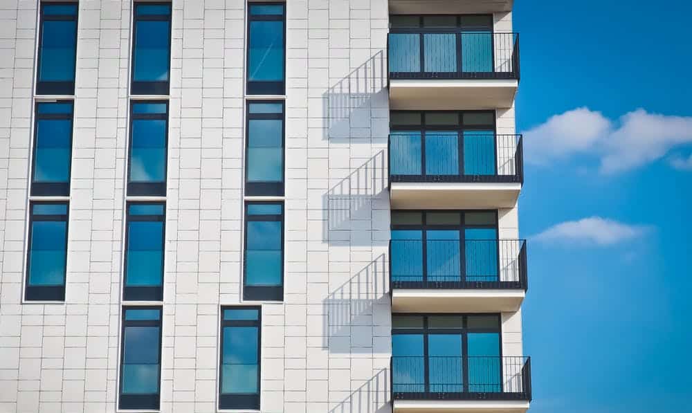
Oblique Shots
Looking down at an angle – with horizon – shoot from three different altitudes

Example of Oblique Shot of Commercial Real Estate
Note: Oblique shots should always include the horizon in the top 15% to 25% of the frame.
- Oblique Elevations
(shoot from three different altitudes)
Note: Altitudes vary, depending on population density. For sparsely populated areas, shoot from a higher altitude to capture more of the surrounding area.
- Oblique Shots from Corners and Sides – with horizon – shoot looking down at an angle from:
- Each side (all major building facades – front, sides and back)
- All four corners of the building
- All cardinal compass points (N, E, S, W), and points in between
- Include shots that feature signage in foreground and property in background
- Show proximity to roadways and highways to indicate points of ingress/egress
- Wherever possible, include surrounding properties in frame
- Show proximity to other land parcels, shopping centers, and population centers
- Make every effort to include features that may attract clientele for a potential buyer or tenant.
- Is the property in a strip mall, next to a major hotel or retail chain? Include it! e.g., if you are shooting a grocery store that is adjacent to a major hardware store, be sure to get photos that depict both stores to provide context for the prospective client.
- For restaurant or retail space, shoot at a time of peak usage – when the parking lot is full (you want to show a busy property!)
- Oblique Shots from Corners and Sides – with horizon – shoot looking down at an angle from:
- Detail Photos
In addition to shooting the property’s best shots and angles, be sure to capture aerial photos of any “less desirable” features such as trash enclosures, structures or vehicles abandoned on the property, nearby industrial activity such as an oil well or quarry, etc. Shoot these separately and leave it to the broker’s discretion as to what he or she wishes to use for marketing or disclosure purposes.
Use Intuitive and Consistent Photo File Naming Conventions
Name each photo file with the shot type, corresponding features and/or compass points, e.g.,
- Aerial_Nadir_Full_Lot.jpg
- Aerial_Looking_North.jpg
- Aerial_Looking_NE.jpg
- Aerial_NW_Corner_Looking_South.jpg
- . . .
Key Video Footage to Shoot
When shooting video, as with stills, be sure to show off the property’s best features. Here is a list of key footage to shoot:
Dolly Shots
- Dolly shots of the façade(s)
Facing front of building – move slowly from left to right and right to left from various distances and elevations. Start dolly movement before one side of property and end past other side.- Dolly – Distant
- Dolly – Close
Panoramas
- Panos (left to right and right to left)
Drone stays stationary at horizontal centerline of building while camera pans (rotates) from side to side.
Flyovers
- Flyovers – Close (8 passes)
Keep horizon in top 15% of frame.- Flyovers from front to back and back to front
(2 passes) - Flyovers from side to side
(2 passes – left to right and right to left) - Flyovers from corner to corner in all directions
(4 passes)
- Flyovers from front to back and back to front
- Flyover – Distant
Keep horizon in top 15% of frame.- Flyover to feature adjacent properties, proximity to points of ingress/egress, signage, and full parking lot.
Orbits
- 360 Degree Orbit with Horizon
Include surrounding roads and highways, buildings, topographic features and/or other areas of interest with horizon visible in top 15% of frame.
Note: Taller buildings may require a second orbit to feature signage. - 360 Degree Orbit Without Horizon
Oblique angle featuring property and surrounding streets only – no horizon.
Fade-Away
- Fade-Away (“Dronie”)
Start close to property. Fly up and back while keeping camera focused on property with horizon in top 15% of frame.
Use Intuitive and Consistent Video File Naming Conventions
Name each video file with the shot type, corresponding features and/or compass points, e.g.,
- Flyover_North-South.mov
- Flyover_Corners_1.mov
- Pano_1.mov
- Full_360_Orbit_1.mov
- . . .
Detail Video Footage
- Roof and HVAC Flyover
- Low, slow pass over roof with camera in Nadir position (straight down) to see details – may require multiple passes to cover entire roof.
- Low, slow pass over roof with camera in Nadir position (straight down) to see details – may require multiple passes to cover entire roof.
- Parking Lot Flyover
- Low, slow pass over parking lot with camera in Nadir position (straight down) to see details – may require multiple passes to cover entire parking lot.
- Low, slow pass over parking lot with camera in Nadir position (straight down) to see details – may require multiple passes to cover entire parking lot.
- Trash Enclosure Flyover
- Low, slow pass over trash enclosure(s) with camera at oblique angle to see details – may require multiple passes if more than one trash enclosure.
- Low, slow pass over trash enclosure(s) with camera at oblique angle to see details – may require multiple passes if more than one trash enclosure.
- Signage Flyover
- Slow pass starting at ground and going up one side of the entire sign, over, and down the other side of the sign. May require multiple passes if more than one sign.
5) Shoot Everything in RAW
Why shoot RAW versus JPEG? Simply stated, RAW gives you the highest level of quality and records a greater range of brightness.
All cameras technically shoot RAW, meaning that every time you snap the shutter you are capturing all the RAW data directly from the sensor. However, the data compression that occurs during the JPEG conversion process discards some of the RAW data, significantly reducing image quality. JPEG compression severely limits flexibility in post-production to correct things like exposure and color temperature. When you shoot RAW, you skip the JPEG compression and conversion process and capture all the data straight from the sensor. This allows you to do the processing and make key decisions on the appearance of the image to produce much better results in post-production.
Think of RAW versus JPEG like high-definition versus standard-definition television in terms of the quality and depth of color it provides.
Final Thoughts
Aerial drone photography for commercial real estate may sound like a simple thing, but it’s easier said than done. Before shooting your first real gig, find a nearby strip mall, warehouse or piece of vacant land, then get out there and practice until you’ve mastered the list of photo and video shots above. Put together a killer portfolio and a demo reel, then get out there and make some money!
From The Editor:
Do you need to hire a professional drone service provider? To speak to an aerial data specialist, fill out a form, email us or for even faster response times, give us a call at (833) FLY-4YOU or (833) 359-4968. Check out our transparent pricing at Drone Photography Pricing and watch this space as we expand on the above topics and more over the coming weeks and months. If you like this post, feel free to click the share button at the bottom of the page. We appreciate you helping us by spreading the content we share on our blog.

Founder | CEO at Aerial Decisions
Jim Gibson is the Founder of Aerial Decisions and an FAA Part 107–certified commercial drone pilot with direct experience supporting commercial construction projects across Southern California. He brings more than a decade of leadership experience in digital marketing, sales strategy, and entrepreneurship, and writes from firsthand experience integrating drone technology into real-world construction workflows.
Latest posts by Jim Gibson (see all)
- Photogrammetry in Commercial Construction: Turning Drone Images into Measurable Data - February 25, 2026
- Elevating Construction Project Management with Drone Data: What Owners Actually Care About - February 19, 2026
- Drone Mapping for Commercial Construction Projects - January 2, 2026
