by Jim Gibson
Most people are well aware that drones have cameras and can take photos and videos while in flight. But few outside the industry realize just how useful those pictures and videos can be for a variety of business, real estate, agriculture, construction, insurance and more.
Drones are capable of highly technical data collection using a variety of on-board technology, sophisticated cameras and 3rd party software. From inspections and infrastructure management to surveying and mapping, we have only just begun to realize the full potential for drone technology to deliver value for industries of all types.
If you’re new to the drone industry it can sometimes feel daunting to keep up with the technology and the myriad of commercial applications that drones can handle. One of the more common uses of drones for industry involves the use of photogrammetry.
What is Photogrammetry?
Photogrammetry involves taking multiple pictures of an object, for example aerial photographs of an empty parcel of land, and assembling them into complex 2D or 3D models.
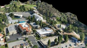
Glendale Adventist 3D Map
These models can be used by industries ranging from construction, real estate, agriculture and more to understand and evaluate development requirements; oftentimes much faster and with less cost than conventional methods.
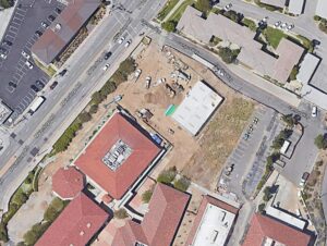
Once assembled into the the final image, the individual images are stitched together to form a new, sharper image called an Orthomosaic.
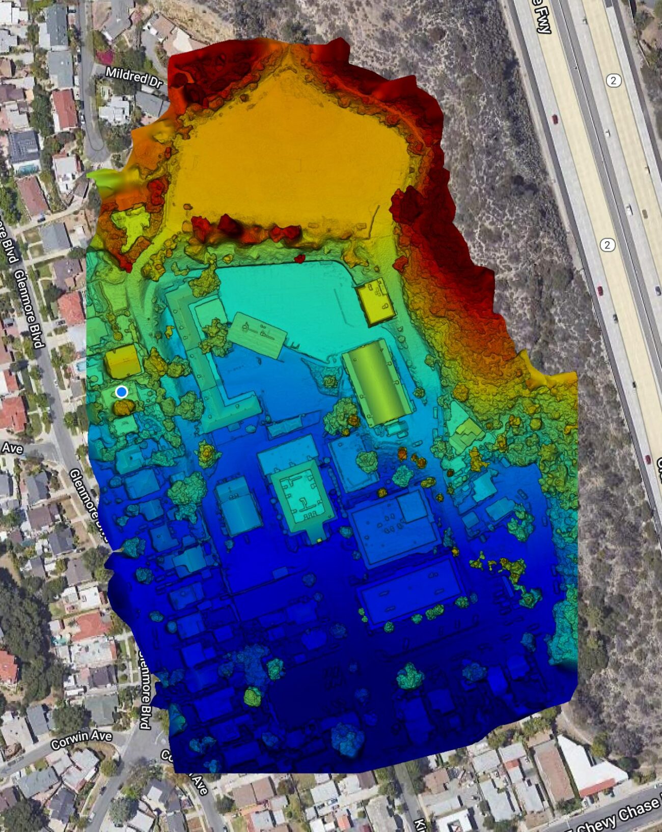
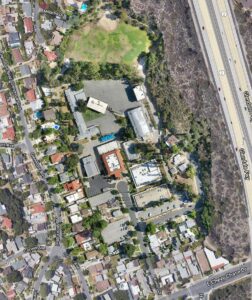
Google Maps Image

Orthorectified Image
What is an Orthomosaic?
Orthorectified Image
An orthomosaic is a large, map quality, image made by stitching together a significant number of smaller, individual images (called orthophotos) into one high resolution image.
Orthoimages are aerial photos that are corrected for:
- Lens Distortion
- Camera Tilt
- Perspective
- Topographic Relief (adjusted for the curvature of the earth’s surface)
These Orthoimages have no distortion and are uniformly scaled across the image. The main difference between a typical aerial photo and an orthophoto is:
The aerial photo shows the effects of the natural curvature of the earths surface (showing, for example, the sides of buildings from a top down perspective) while the orthophoto is geometrically corrected. This orthorectified image presents a geometrically accurate top down view of objects on the ground.
How are Othomosaics Being Used?
When integrated into sophisticated software (like Drone Deploy), Orthomosaics are used to get the most up to date aerial view of an object on the earth’s surface; for example, a parcel of land or new construction project. Real estate professionals consider orthomosaics to be the best way to get an up to date and accurate aerial photo of a large parcel of land. Construction firms look to this type of aerial image as a way to get accurate measurements of a project as well as regular updates on the progress of each construction site. Agriculture can use orthorectified images to inspect crops and determine plant health. Drones can also produce images that, when converted into orthomosaics, can be used to aid in inspecting rooftops, buildings, solar panels, bridges, pipelines and cell towers.
And the list goes on.
Why Are Orthomosaics Important?
In short, orthoimages can be used to help streamline processes, create massive efficiencies of scale and help industries save valuable time and money. Whether you need aerial photography services for construction, real estate, land development or inspections, Aerial Decisions can handle all of your photogrammetry needs.
From The Editor:
Do you need to hire a professional drone service provider? To speak to an aerial data specialist, fill out a form, email us or for even faster response times, give us a call at (833) FLY-4YOU or (833) 359-4968. Check out our transparent pricing at Drone Photography Pricing and watch this space as we expand on the above topics and more over the coming weeks and months. If you like this post, feel free to click the share button at the bottom of the page. We appreciate you helping us by spreading the content we share on our blog.

Founder | CEO at Aerial Decisions
Jim Gibson is the Founder of Aerial Decisions and an FAA Part 107–certified commercial drone pilot with direct experience supporting commercial construction projects across Southern California. He brings more than a decade of leadership experience in digital marketing, sales strategy, and entrepreneurship, and writes from firsthand experience integrating drone technology into real-world construction workflows.
Latest posts by Jim Gibson (see all)
- Photogrammetry in Commercial Construction: Turning Drone Images into Measurable Data - February 25, 2026
- Elevating Construction Project Management with Drone Data: What Owners Actually Care About - February 19, 2026
- Drone Mapping for Commercial Construction Projects - January 2, 2026
